 Polish Polar DataBase
Hansbreen, Southern Spitsbergen, Svalbard, Norway
Type of resources
Available actions
Topics
Keywords
Contact for the resource
Provided by
Years
Representation types
Update frequencies
status
Scale
-
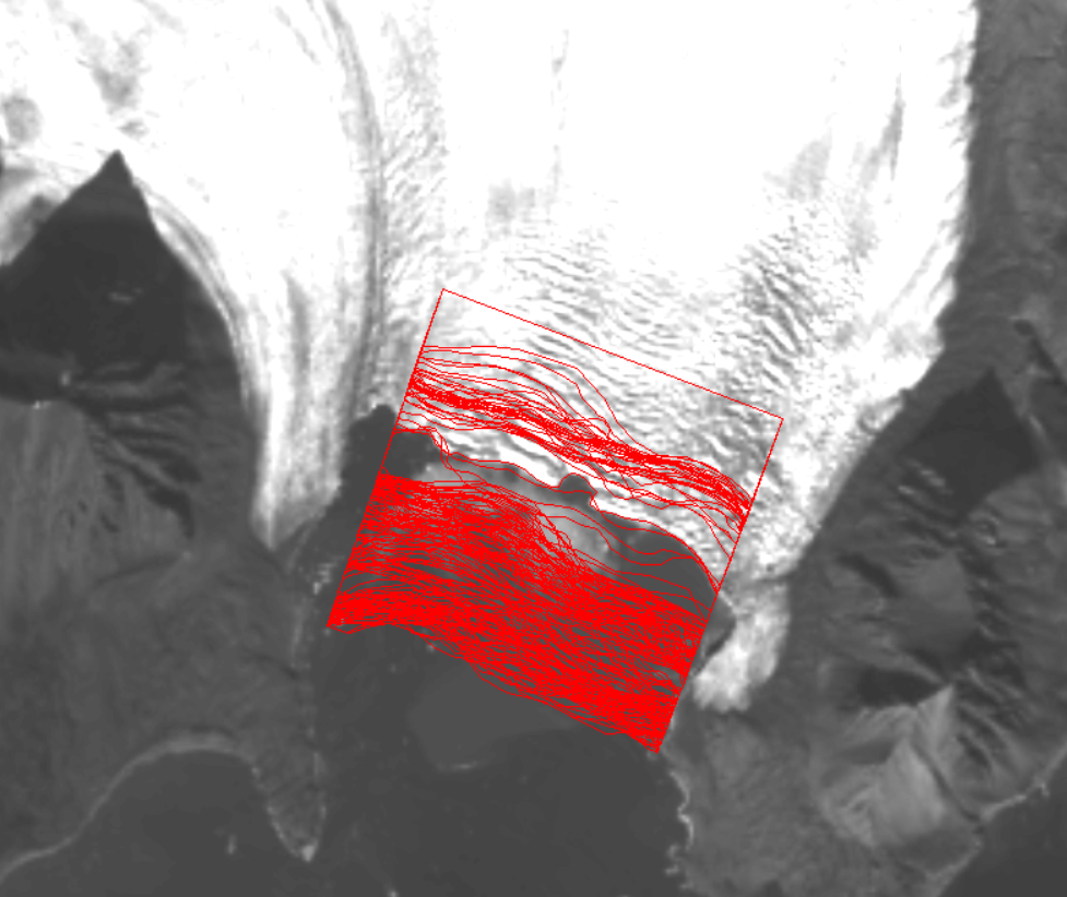
The position of the terminus of Hansbreen is derived with very high frequency in the period 1991–2015. Over 160 multispectral and Synthetic Aperture Radar (SAR) data were used: LANDSAT 5, LANDSAT 7, LANDSAT 8, Terra ASTER, Alos AVNIR, SPOT 5, ERS-1, ERS-2, ENVISAT, Alos PALSAR, TerraSAR-X, TanDEM-X, and Sentinel-1. Terra ASTER images were orthorectified with use of 2008 DEM SPOT and geocoded in PCI Geomatica and ArcGIS software. Multispectral, already terrain-corrected images were rectified in ArcGIS software. SAR data were provided at the Single Look Complex level and that both radiometric and geometric corrections were applied using the same methods, and with the same digital elevation model (2008 DEM SPOT). The SAR data were processed in BEAM (http://www.brockmann-consult.de/cms/web/beam). Sentinel data downloaded from the Sentinel’s Data Hub were already processed. The satellite data were digitized manually to obtain the front position. The database is the supplement to the paper: Małgorzata Błaszczyk, Jacek A. Jania, Michał Ciepły, Mariusz Grabiec, Dariusz Ignatiuk, Leszek Kolondra, Aleksandra Kruss, Bartłomiej Luks, Mateusz Moskalik, Tadeusz Pastusiak, Agnieszka Strzelewicz, Waldemar Walczowski, Tomasz Wawrzyniak. “Factors controlling terminus position of Hansbreen, a tidewater glacier in Svalbard”, Journal of Geophysical Research - Earth Surface, https://doi.org/10.1029/2020JF005763.
-
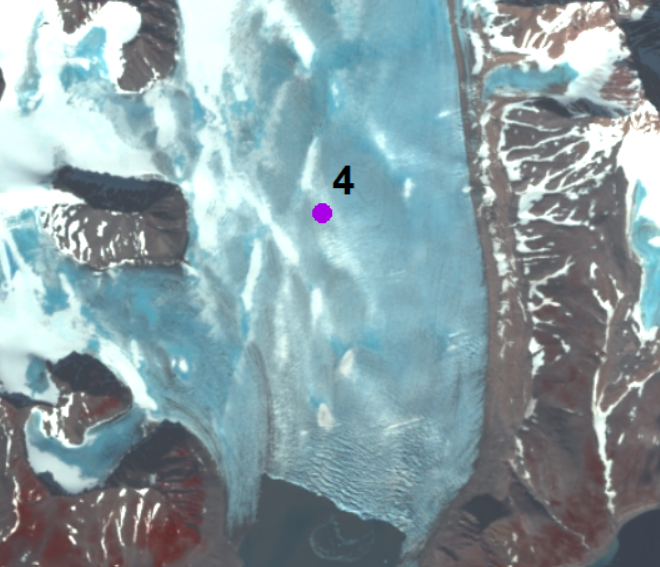
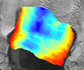
The annual velocity of Hansbreen in the period 2007–2015 is determined at stake No. 4 located approximately 3.5 km upstream of the glacier terminus (15°28`E, 77°02`N). Monitoring of the glacier is conducted by Institute of Geophysics Polish Academy of Science. The stake position was measured by the differential GPS receiver at the turn of each year (December/January) (with a horizontal accuracy of ±4 cm). Velocity along the Hansbreen terminus in 2009 and 2015 is processed from repeated terrestrial laser scanning in August 2009 and August 2015. Values of displacements of the same features along the calving front (distinctive edges of crevasses) for approximately two weeks were provided with an accuracy of around 10 cm. The database is the supplement to the paper: Małgorzata Błaszczyk, Jacek A. Jania, Michał Ciepły, Mariusz Grabiec, Dariusz Ignatiuk, Leszek Kolondra, Aleksandra Kruss, Bartłomiej Luks, Mateusz Moskalik, Tadeusz Pastusiak, Agnieszka Strzelewicz, Waldemar Walczowski, Tomasz Wawrzyniak. “Factors controlling terminus position of Hansbreen, a tidewater glacier in Svalbard”, Journal of Geophysical Research - Earth Surface, https://doi.org/10.1029/2020JF005763.
-
Average terminus height above sea level for the period 1992–1996, 2000 and 2010 was acquired with an accuracy of ±1.5 m, using terrestrial photogrammetry. The glacier terminus height in September 2009 and 2015 was measured using precise laser scanning with an accuracy of ±0.5 m. The height data obtained using photogrammetry and a laser scanner are averaged along the ice face. The database is the supplement to the paper: Małgorzata Błaszczyk, Jacek A. Jania, Michał Ciepły, Mariusz Grabiec, Dariusz Ignatiuk, Leszek Kolondra, Aleksandra Kruss, Bartłomiej Luks, Mateusz Moskalik, Tadeusz Pastusiak, Agnieszka Strzelewicz, Waldemar Walczowski, Tomasz Wawrzyniak. “Factors controlling terminus position of Hansbreen, a tidewater glacier in Svalbard”, Journal of Geophysical Research - Earth Surface, https://doi.org/10.1029/2020JF005763.
-
Changes in position of glacier front are obtained from a Riegl FG21-LR laser distance ranger (the temporal resolution of 10 minutes) taken during September 2009 – February 2013. The database is the supplement to the paper: Małgorzata Błaszczyk, Jacek A. Jania, Michał Ciepły, Mariusz Grabiec, Dariusz Ignatiuk, Leszek Kolondra, Aleksandra Kruss, Bartłomiej Luks, Mateusz Moskalik, Tadeusz Pastusiak, Agnieszka Strzelewicz, Waldemar Walczowski, Tomasz Wawrzyniak. “Factors controlling terminus position of Hansbreen, a tidewater glacier in Svalbard”, Journal of Geophysical Research - Earth Surface, https://doi.org/10.1029/2020JF005763.
-
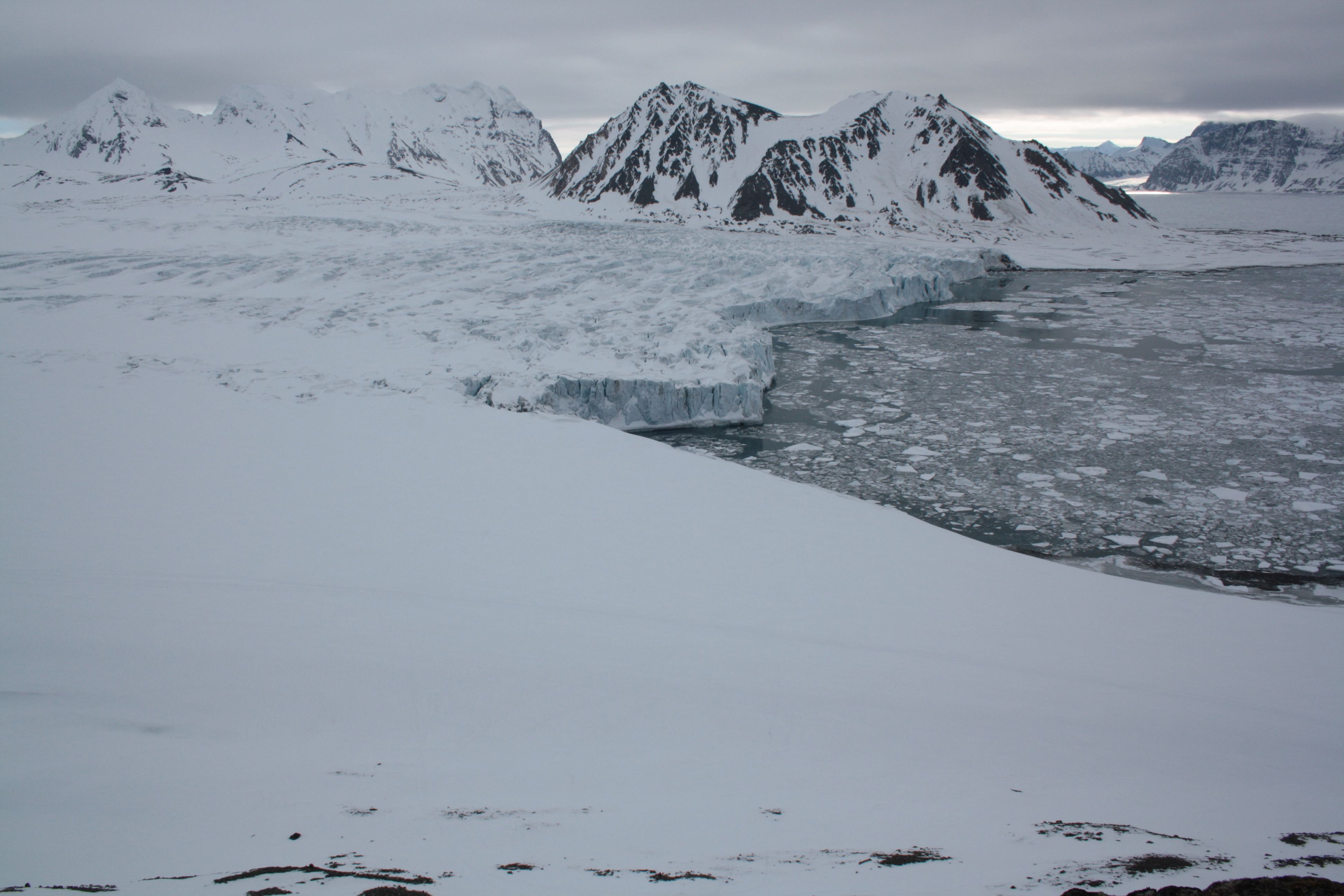
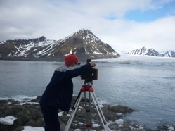
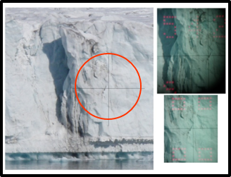
Ice condition directly at the Hansbreen front is obtained from visual interpretation of oblique pictures taken at 3 h intervals by Canon EOS 1000D time-lapse photography (Figure 1) for the period 2010–2015 (http://ppdb.us.edu.pl/geonetwork/srv/pol/catalog.search;jsessionid=muhaqbum8pz21xknjo0crhodn?node=srv#/metadata/cf6a17fd-ec3a-4ff6-8232-67a0dc5957d4) The database is the supplement to the paper: Małgorzata Błaszczyk, Jacek A. Jania, Michał Ciepły, Mariusz Grabiec, Dariusz Ignatiuk, Leszek Kolondra, Aleksandra Kruss, Bartłomiej Luks, Mateusz Moskalik, Tadeusz Pastusiak, Agnieszka Strzelewicz, Waldemar Walczowski, Tomasz Wawrzyniak. “Factors controlling terminus position of Hansbreen, a tidewater glacier in Svalbard”, Journal of Geophysical Research - Earth Surface, https://doi.org/10.1029/2020JF005763.
-
The bathymetry data for Hansbukta includes depth measurements from different sources: data collected in 2014, 2016 and 2017 from a small boat using a Norbit Wideband Multibeam Sonar with positioning system, measurements collected in 2015 from a small boat using single beam echosounder Lowrance HDS5 with positioning and data from the Norwegian Hydrographic Service collected using a multi-beam survey in 2007–2008. Accuracy of the bathymetry from these different sources is assessed as ±5 m. The database is the supplement to the paper: Małgorzata Błaszczyk, Jacek A. Jania, Michał Ciepły, Mariusz Grabiec, Dariusz Ignatiuk, Leszek Kolondra, Aleksandra Kruss, Bartłomiej Luks, Mateusz Moskalik, Tadeusz Pastusiak, Agnieszka Strzelewicz, Waldemar Walczowski, Tomasz Wawrzyniak. “Factors controlling terminus position of Hansbreen, a tidewater glacier in Svalbard”, Journal of Geophysical Research - Earth Surface, https://doi.org/10.1029/2020JF005763.
-
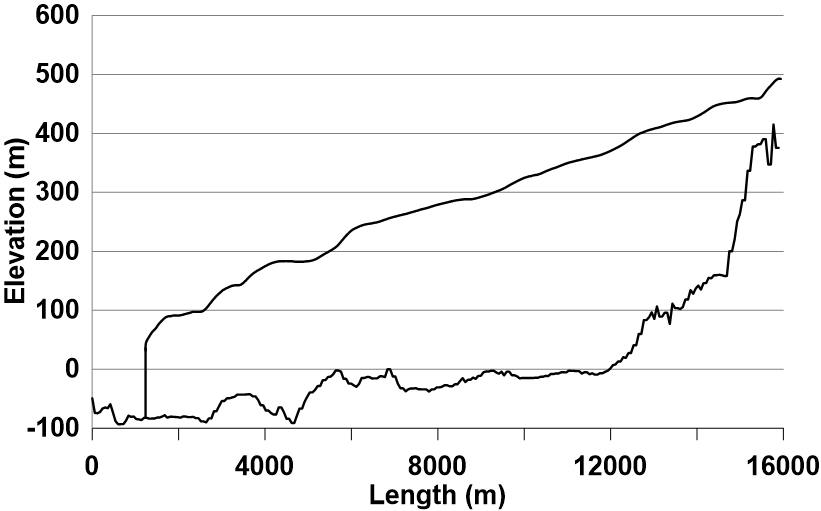
The longitudinal profile of the glacier surface is derived from continuous DEM generated from WorldView-2 satellite data (Błaszczyk et al., 2019), while profile of the bed under the glacier is interpolated from ground-penetrating radar data (Grabiec et al., 2012). Grabiec, M., Jania, J. A., Puczko, D., Kolondra, L., & Budzik, T. (2012). Surface and bed morphology of Hansbreen, a tidewater glacier in Spitsbergen. Polish Polar Research, 33(2), 111–138. https://doi.org/10.2478/v10183−012−0010−7 Błaszczyk, M., Ignatiuk, D., Grabiec, M., Kolondra, L., Laska, M., Decaux, L., Jania, J., Berthier, E., Luks, B., Barzycka, B., & Czapla, M. (2019). Quality assessment and glaciological applications of digital elevation models derived from space-borne and aerial images over two tidewater glaciers of southern Spitsbergen. Remote Sensing, 11(9), 1121. https://doi.org/10.3390/rs11091121 The database is the supplement to the paper: Małgorzata Błaszczyk, Jacek A. Jania, Michał Ciepły, Mariusz Grabiec, Dariusz Ignatiuk, Leszek Kolondra, Aleksandra Kruss, Bartłomiej Luks, Mateusz Moskalik, Tadeusz Pastusiak, Agnieszka Strzelewicz, Waldemar Walczowski, Tomasz Wawrzyniak. “Factors controlling terminus position of Hansbreen, a tidewater glacier in Svalbard”, Journal of Geophysical Research - Earth Surface, https://doi.org/10.1029/2020JF005763.